

How about a map?

25th February, 2010
How about a map?
I enjoy reading Docklands News, but get confused as to where all the different locations are, for example NewQuay, South Wharf, Waterfront City, Yarra’s Edge, Harbour Town, as well as the location of the community garden and the various streets such as St Mangos Lane.
Would it not be possible to include a small map in each edition to help those who don’t necessarily live in the area? There seem to be new streets opening up all the time.
Max
Related Articles

Council’s funding of Docklands Farmers Market takes money from the communities in need
May 29th, 2024 - Docklands News
The City of Melbourne and Docklands Chamber of Commerce are planning to bring a monthly Farmers Market to Docklands by the end of this year. With the ongoing Senate inquiry into the major supermarkets’ behaviour, the more choices consumers get the better the outcomes for everyone.
Read More
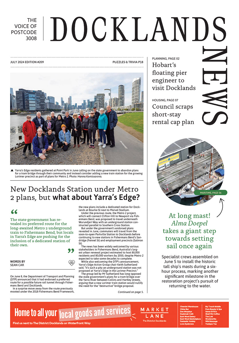
New Docklands Station under Metro 2 plans, but what about Yarra’s Edge?
June 26th, 2024 - Sean Car

Central Pier afloat? Brooke Street Pier engineer to visit Docklands
June 26th, 2024 - Sean Car
Subscribe to all the news
Join Our Facebook Group
 Download the Latest Edition