

A narrow river

By Ashley Smith - Royal Historical Society of Victoria
This image from the Royal Historical Society of Victoria’s (RHSV’s) collection, taken in the 1850s, is a rare look at the Yarra river before it underwent many facelifts in the following decades.
It was taken from the city side of the river, looking toward the region we now know as South Melbourne and Southbank.
Back then the river that flowed along the docks resembled a creek rather than the much wider canal we know today. While the width during this time varied along the river course, this particular portion appears to be around four ship-widths, which would have made any attempts to turn back towards the bay a nightmare. Generally smaller ships could access the wharves of Melbourne, with many being lighters that hauled cargo from larger ships around the winding narrow bend known as Fisherman’s Bend. Depending on the ship size and the depth of the river, the 6km journey from Port Phillip Bay to Melbourne could take days to complete.
From the 1840s, wharfs were built to assist the unloading of cargo and the wide-eyed immigrants looking for a new life. By the time this image was taken, the south-west end of Melbourne was dominated by Queen’s Wharf (west of King St), Coles and Raleigh Wharves (between King and Spencer streets), and Spencer Wharf at the end of Spencer St. The exact location of the photograph is thought to be (and has been cited elsewhere) as Australian Wharf, now at the site of the current World Trade Centre, west of Spencer Street Bridge. Extending to 2032 feet, the wharf was built in 1855 in a time when news of the gold rush lured vast numbers of ships deep into the bay. The site held auctions for goods fresh off the boat, with July 11, 1856 edition of The Argus recording a sale of produce by Messrs Symons and Perry. Being close to the newly-opened gasworks, the wharf also included a small dock that allowed coal ships to unload their freight. The wharf would continue to be used until the 1970s when the Charles Grimes Bridge blocked off traffic.
Activity was also happening on the south side of the river. The scattering of homes and huts in the distance signal the formation of what was formerly known as Emerald Hill. In between the few shacks along the south bank (which risked constant flooding) and the settlement itself is a sizeable swamp, a result of water collecting in the low lying delta plains. Emerald Hill allegedly got its name from journalist and would-be historian Edmund “Garryowen” Finn in 1845 to promote a picnic for the Father Matthew Society. This referred to the grassy hill that rose from the swamplands (not visible in this image, but likely would’ve been right). Inhabited by the Yalukit Willam (a clan of the Bunurong) before European settlement, Emerald Hill and its surrounding area was a traditional social and ceremonial meeting place for many indigenous tribes, with one notable meeting in 1840 witnessed by poet Richard Howitt reportedly attracting around 1000 participants. The meeting featured a ceremonial battle to settle a dispute (with one man being speared in the leg), with a reconciliation dance held the next night.
A small number of Europeans settled on the land, but it wasn’t until 1852 that the area would experience a larger European expansion as the first allotments were sold. This was coupled with the formation of a tent settlement, known as Canvastown, along St Kilda Rd organised by Governor La Trobe. For five shillings a week, immigrants would live in a tent while they searched for work or gambled their livelihoods on the goldfields up north. For the almost 10, 000 people that lived there, times were tough. One woman writing to The Argus in 1853 (January 26) lamented the hardships she and her family had gone through in five weeks, claiming “we can, in common with hundreds, see nothing before us but absolute starvation”. As her husband was robbed while struggling to find work, her family had to deal with a tent that was too thin to keep out the rain and the foul language of neighbours. Another immigrant writing to The Argus (January 24, 1853) solemnly announced that “death has broken into several of our families”. As Canvastown was also marred by crime, poor sanitation (due to the polluting of the Yarra), and a fever epidemic, La Trobe would put a stop to the settlement after a couple of years.
West of Canvastown, more practical homes of weatherboard were being constructed, along with nearly 100 portable iron houses. The iron houses were the 19th century equivalent of Ikea furniture as they could be constructed in England, disassembled for transport to Australia, then reassembled. These included a parsonage for the Church of England, and Patterson House at Coventry St which still remains in its original spot more than 160 years later. As inns and shops were set up and the population reached more than 3000 people, there was dissatisfaction expressed towards the neglect by the Melbourne City Council, which was in charge of the town. It sparked a push for Emerald Hill to become its own municipality, with an 1855 petition claiming that “filth (sickness and disease supervening) is a sequence of the neglect of proper supervision.” While legislation allowing settlements to become separate boroughs would pass in 1854, there were further disputes by the council on the legality of the separation. This led to several meetings at an Iron Store in Cecil St, including one that the Argus (May 9, 1855) reportedly claimed as “disorderly” as a vocal crowd interrupted proceedings. However, it would be worth the trouble, as Emerald Hill would be declared a municipal district on May 26, 1855.
The Yarra is now wider and, with all the reclamation works and urban expansion, most of the swamp is gone •

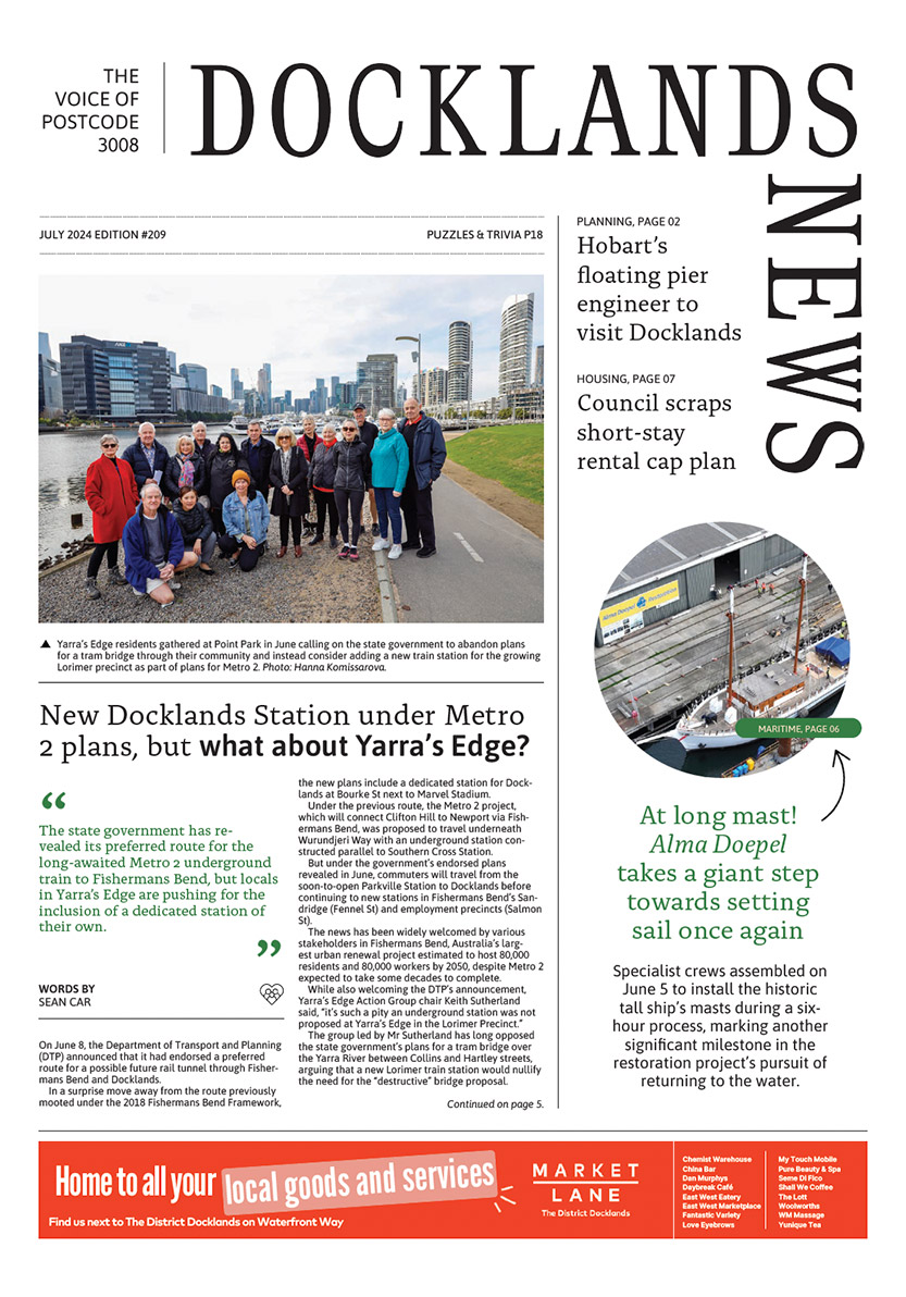
New Docklands Station under Metro 2 plans, but what about Yarra’s Edge?

Central Pier afloat? Brooke Street Pier engineer to visit Docklands
 Download the Latest Edition